
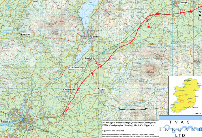
N7 Nenagh-Limerick High Quality Dual Carriageway,
Counties Limerick and Tipperary
The road project starts at the existing Newport Junction on the north side of Limerick, runs north-eastwards towards Nenagh and continues to Ballintotty at the end of the Nenagh Bypass, which will be widened. The total length of the route is 35.7 km
www.n7nenaghtolimerick.com
www.midwestroads.ie
Following the initial test trenching, four archaeological contractors were appointed to carry out excavation, further test trenching and monitoring. The results described here are only for the sites excavated by TVAS (Ireland) Ltd.
The archaeological fieldwork and post-excavation work were funded by Limerick County Council through the National Roads Authority.
Summary of archaeological sites on the N7 Nenagh-Limerick HQDC
The sites range in date from the Neolithic to the post-medieval period. Radiocarbon dates received so far are included in the summaries below and reports will be added in due course.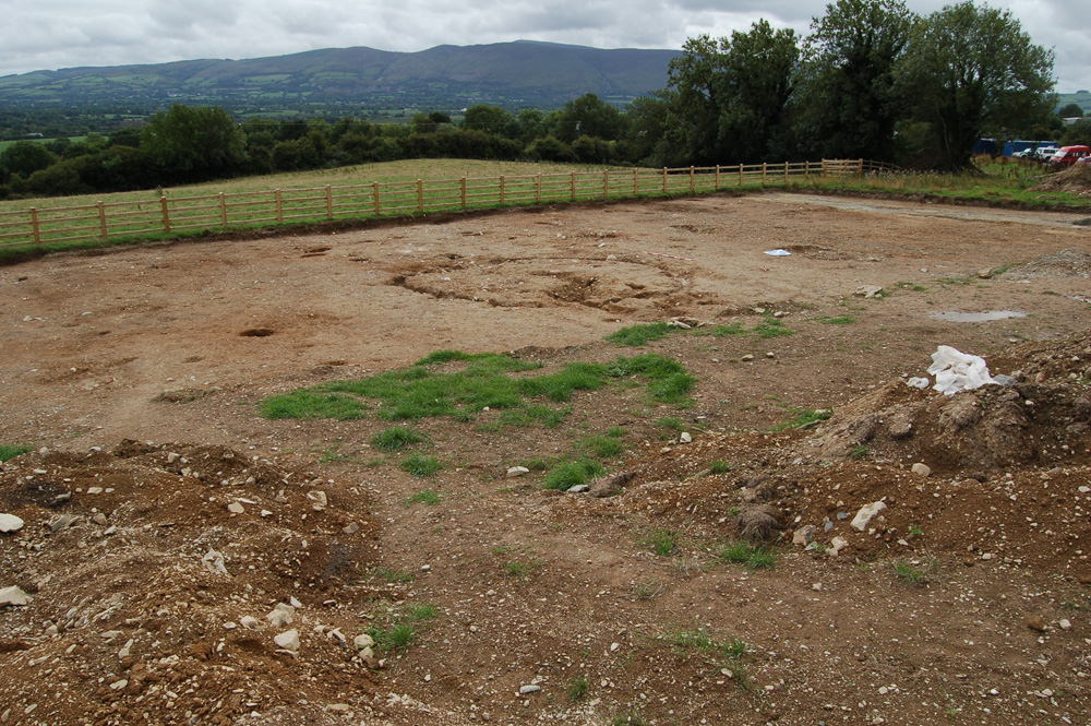
E2285 Carrigatogher (Harding) Site 5, Co. Tipperary
NGR: 180966 176364 to 181082 176503
Licence holder: Markus Casey
Report author: Astrid Nathan and Edel Ruttle
Summary: The site contained three roundhouses, pits, postholes, a modern drain and fulacht fia material. One of the roundhouses has been radiocarbon dated to the Middle Bronze Age 1500 to 1380 cal. BC (Beta-244820, 3160±40 BP).
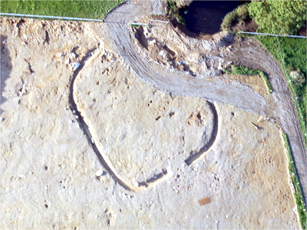
E2286 Carrigatogher (Harding) Site 6, Co. Tipperary
NGR:180900 176285 to 180952 176360
Licence holder: Markus Casey
 Report author: Kate Taylor
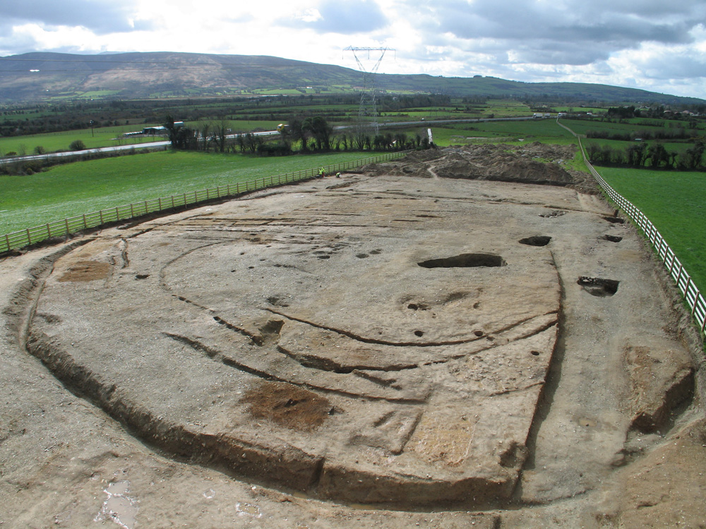
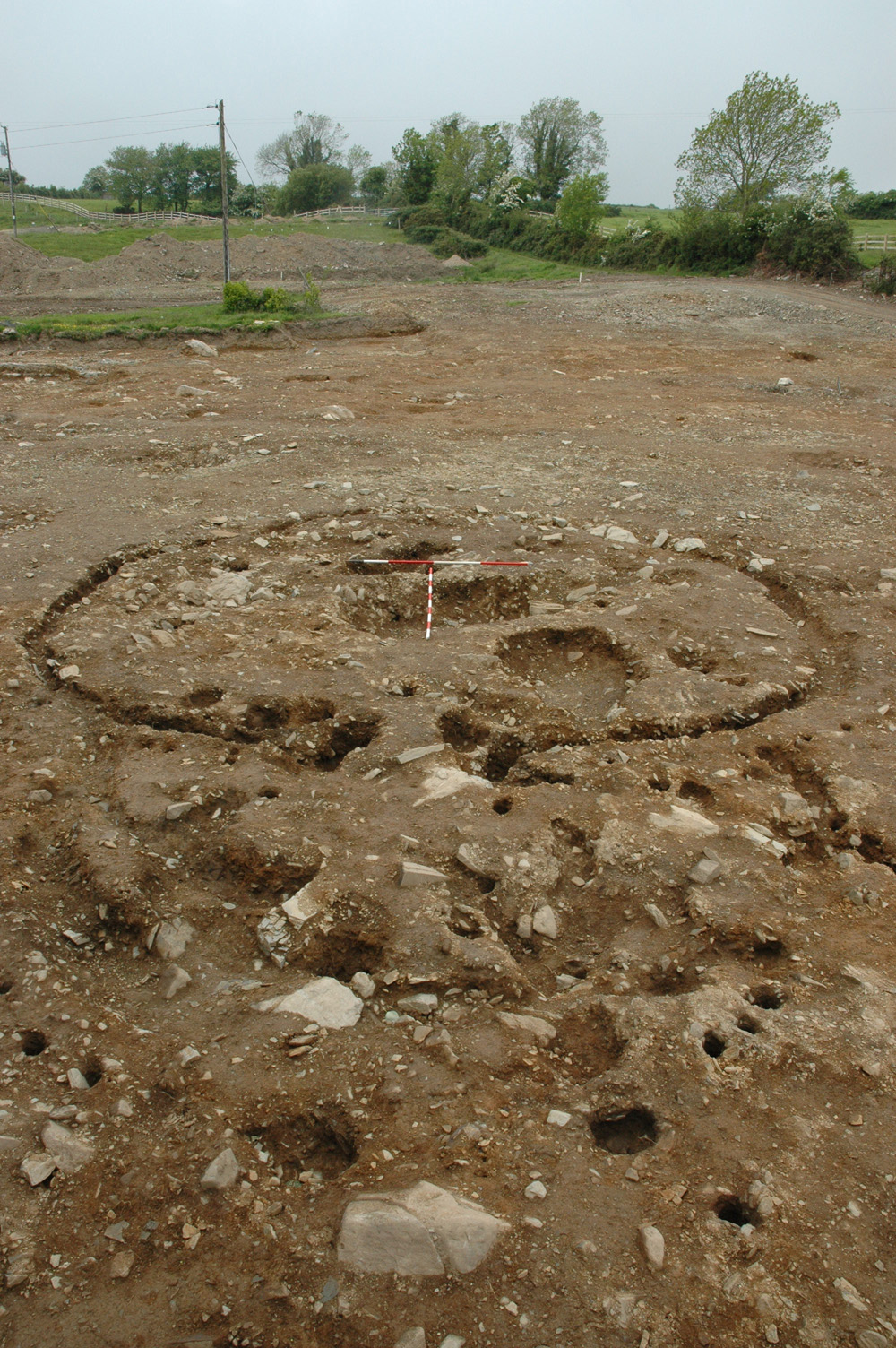
Summary: This large and complex site contained a fulacht fia, a multiphase early medieval enclosure, early medieval graves, a rectangular structure, a kiln, iron-working waste, pits and postholes. A radiocarbon determination dated the fulacht fia to the Middle Bronze Age, 1400 to 1130 cal. BC (Beta-249824, 3020±40 BP). The enclosure ditches produced several early medieval dates: cal. AD 590-670 (Beta-244821, 1400±40 BP), cal. AD 610-680 (Beta-249825, 1380±40 BP), cal. AD 590-810 (Beta-249826, 1340±70 BP), cal. AD 570-680 (Beta-249823, 1400±50 BP). One of the graves in the central cemetery was also dated to the early medieval period, approximately contemporary with the enclosure ditches: cal. AD 550-660 (Beta-244823, 1450±40 BP) and the structure produced an unusually early (and rather suspect) Iron Age or early medieval date: cal. AD 330-540 (Beta-244822, 1640±40 BP). Further dates will be required to untangle the sequence of activities in this area.
E2287 Carrigatogher (Abbott) Site 1, Co. Tipperary 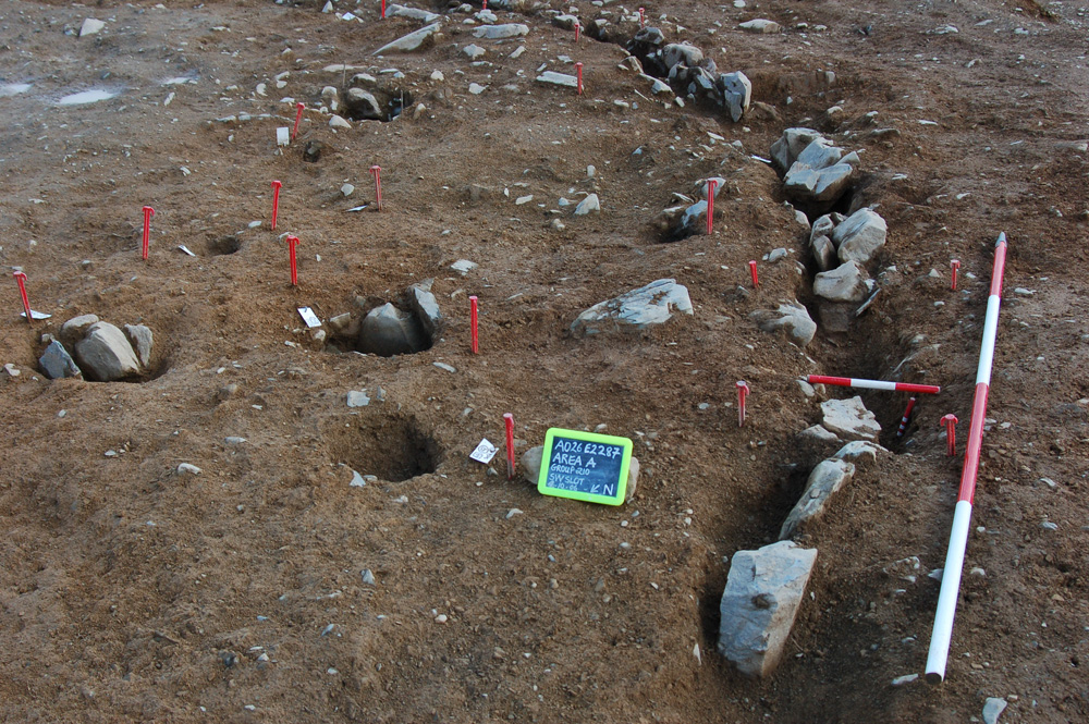
 NGR: 180700E 176010N to 180878E 176280N
Licence holder: Kate Taylor
Report author: Margaret McNamara, Edel Ruttle and Kate Taylor
Summary: Two separate areas were excavated. One contained a D-shaped house, dated to the Middle Bronze Age, 1610-1430 cal. BC (Beta-244824, 3240±40 BP). The larger area contained an early medieval sub-rectangular ditched enclosure with internal and external features dated to cal. AD 660-810 (Beta-244825, 1280±40 BP).
E2479 Ballywilliam Site 1, Co. Tipperary
NGR: 179470 174300 to 179850 174980
Licence holder: Kate Taylor
Report author: Margaret McNamara, Edel Ruttle and Kate Taylor
Summary: Several areas were examined during the excavation of this site. Evidence was found of two fulacht fia spreads, a Middle Bronze Age roundhouse dated to 1530-1410 cal. BC (Beta-244827, 3200±40 BP), pits with prehistoric pottery and a large enclosure that produced an unusual Iron Age radiocarbon date of 170 cal. BC - AD 30 (Beta-244826, 2050±40 BP).
E2480 Cloghleigh Site 1, Co. Tipperary
NGR: 179978 175184 to 180163 175356
Licence holder: Markus Casey and Kate Taylor
Report author: Edel Ruttle
Summary: Isolated pits and spreads of fulacht fia type material.
E2481 Ballyhisky Site 1, Co. Tipperary
NGR: 180325 175554 to 180514 175792
Licence holder: Markus Casey
Report author: Astrid Nathan
Summary: Three isolated pits and a patch of in situ burning were excavated close to a previously recorded ringfort.
E2482 Ballyhisky Site 2, Co. Tipperary
NGR: 180275 175500
Licence holder: Markus Casey
Report author: Edel Ruttle
Summary: Field boundaries, pits, postholes and stakeholes were excavated at this site. The remains represent multi period use of the area. A radiocarbon determination of 3700-3630 and 3560-3540 cal. BC (Beta-244829, 4860±40 BP indicates Early Neolithic activity which is confirmed by pottery identification by Eoin Grogan and Helen Roche. An early medieval date of cal. AD 660-880 (Beta-244828, 1260±40 BP) was also obtained.
 E2483 Ballycuddy More Site 1, Co. Tipperary
NGR: 179840 175000 to 179950 175145
Licence holder: Markus Casey and Kate Taylor
Report author: Edel Ruttle and Kate Taylor
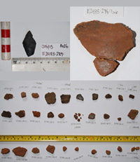
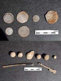
Summary: Pits, postholes and cremation burials were excavated, representing funerary and domestic activity during several prehistoric periods. A large assemblage of Early Neolithic domestic pottery has been examined by Eoin Grogan and Helen Roche. A single sherd of final Neolithic or Early Bronze Age Beakerware came from a feature dated to 2480-2290 cal. BC (Beta-244831, 3910±40 BP). An Iron Age radiocarbon date or 360-290 and 240-50 cal. BC (Beta-244830, 2140±40 BP) was also obtained from one of the possible burials.
E2552 Ballynahinch Site 3, Co. Tipperary NGR: 173520 168200 centre
Licence holder: Kate Taylor
Report author: Aisling Mulcahy, Edel Ruttle and Kate Taylor
Summary: A number of areas were excavated as part of the site at Ballynahinch. Four contained fulacht fia or burnt stone spreads, one a cremation cemetery and the largest area contained five roundhouses, an enclosure, a droveway and a post-medieval field system. None of the sites have yet been dated.
E2902 Ballinteenoe Site 1, Co. Tipperary
NGR: 176430 171070
Licence holder: Kate Taylor
Report author: Kate Taylor
Summary: A small spread of burnt stone associated with a trough and other pits.
E2903 Gortnaskehy Site 1, Co. Tipperary
NGR: 177185 171300 to 177335 171390
Licence holder: Kate Taylor
Report author: Kate Taylor
Summary: Although the only excavated feature was a small hearth, this site produced a large (but broken) flint spearhead.
E2904 Kilnacranna Site 2, Co. Tipperary
NGR: 177370 171364 to 177828 171649
Licence holder: Kate Taylor
Report author: Kate Taylor
Summary: This site contained part of an undated enclosure, a kiln, pits and ditches.
E3264 Castlecranna Site 1, Co. Tipperary
NGR: 178585 172365 to 178775 172750
Licence holder: Margaret McNamara
Report author: Margaret McNamara
Summary: This site contained a ditched enclosure, slots or gullies, pits, postholes and stakeholes. Of particular note is an assemblage of post-medievalcoins and military artefacts recovered from the topsoil. The enclosure ditch produced an early medieval date of cal. AD 540-650 (Beta-244832, 1460±40 BP) whilst an internal pit produced a medieval date of cal. AD 1430-1530 and 1560-1630 (Beta-244833, 400±40 BP), indicating continued use or reoccupation of the site.
E3265 Gortmore Site 1, Co. Tipperary
NGR: 178952 173119
Licence holder: Margaret McNamara
Summary: This was a small site containing two pits, three spreads, modern drains and furrows.
E3325 Carrigatogher (Harding) Site 2, Co. Tipperary
NGR: 181530 176705
Licence holder: Kate Taylor
Report author: Kate Taylor
Summary: A small area encompassed a burnt stone spread and six pits also containing burnt stone.
E3326 Annaholty Site 1, Co. Tipperary
NGR: Area A 169675 165119 and Area B 169644 165071
Licence holder: Margaret McNamara
Report author: Margaret McNamara
Summary: Two fulacht fia were excavated in a particularly wet location. A Middle to Late Bronze Age date was obtained from the larger mound: 1010-810 cal. BC (Beta-249827, 2760±40 BP).
E3327 Carrigatogher (Ryan) Site 3, Co. Tipperary
NGR: 81550 176780
Licence holder: Kate Taylor
Report author: Kate Taylor and Aisling Mulcahy
Summary: This site produced two roundhouses, a smaller structure, a burnt stone spread and trough, pits and postholes. The roundhouses both produced Middle Bronze Age radiocarbon dates, 1870-1840 and 1820-1790 and 1780-1620 cal. BC (Beta-244834, 3420±40 BP) and 1730-1720 and 1690-1510 cal. BC (Beta-244835, 3330±40 BP).
E3370 Cooleen Site 1, Co. Tipperary
NGR: 171090E 166440N
Licence holder: Margaret McNamara
 Report author: Margaret McNamara
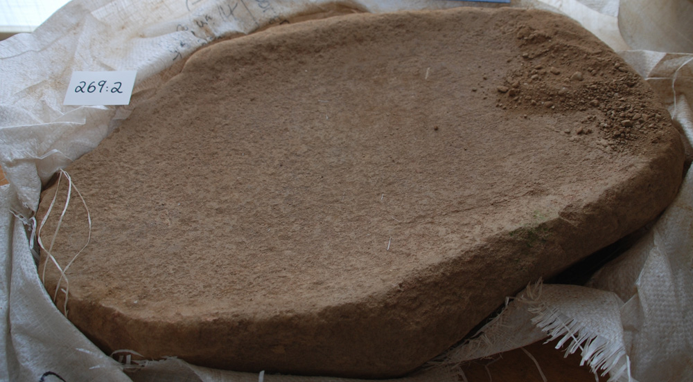
Summary: This was a multi-phase site containing a kiln, posthole structures, find-rich pits and other pits, postholes, stakeholes and linear features. Finds include several exceptionally large saddle querns and a large amount of prehistoric pottery. Middle Bronze Age and Iron Age radiocarbon dates have been obtained: 1460-1310 cal. BC (Beta-244837, 3120±40 BP) and 790-490 and 460-420 cal. BC (Beta-255836, 2500±40 BP).
E3462 Monitoring, Cos Limerick and Tipperary
 NGR: 166300 160300; 168250 163700; 174800 169980
Licence holder: Kate Taylor
Report author: Joseph McCooey and Kate Taylor
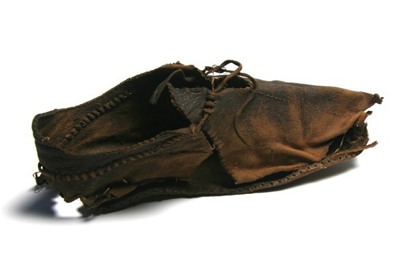
Summary: Construction work in three areas of bog in the townlands of Lisnagry, Ballynacourty, Sallymount, Gardenhill, Cloon & Commons, and Gooig Co. Limerick, Annaholty, and Garraun, Co. Tipperary was subject to archaeological monitoring. Finds include a medieval leather shoe dating from the 11th/12th century and worked wood from the Iron Age, 390-90 cal. BC (Beta-249828, 2200±60 BP). Monitoring also revealed site E3530, a wooden trackway, described below.
E3512 Testing, Cos Limerick and Tipperary
NGR: 165181 157745 to 172238 167276
Licence holder: Kate Taylor
Report author: Aisling Mulcahy and Kate Taylor
Summary: A small amount of additional test trenching was carried out in the town lands of Garraunykee, Carrowkeel, Mountshannon, Rich Hill, Lisnagry, Ballynacourty, Sallymount, Gortnalahagh, Brackloon, Parkwood, Woodpark, Gardenhill, Huntingstown, Cloon & Commons, Gooing, Annaholty, Cooleen, Touknockane, Ballyard, Coolderry, Lackenavea (Dunalley), Co. Limerick and Co. Tipperary.
E3530 Annaholty Site 8, Co. Tipperary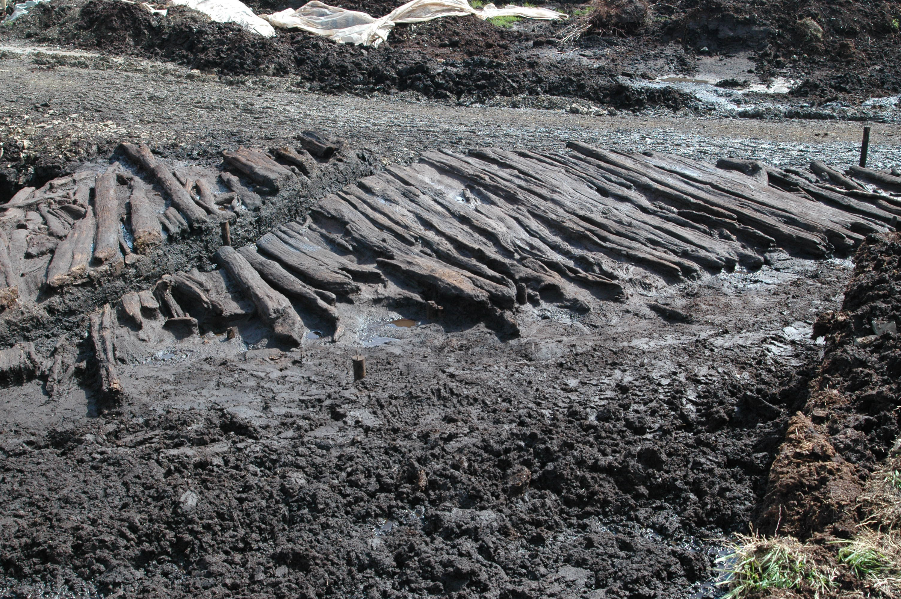
NGR: 168392 163533
Licence holder: Kate Taylor
Report author: Kate Taylor
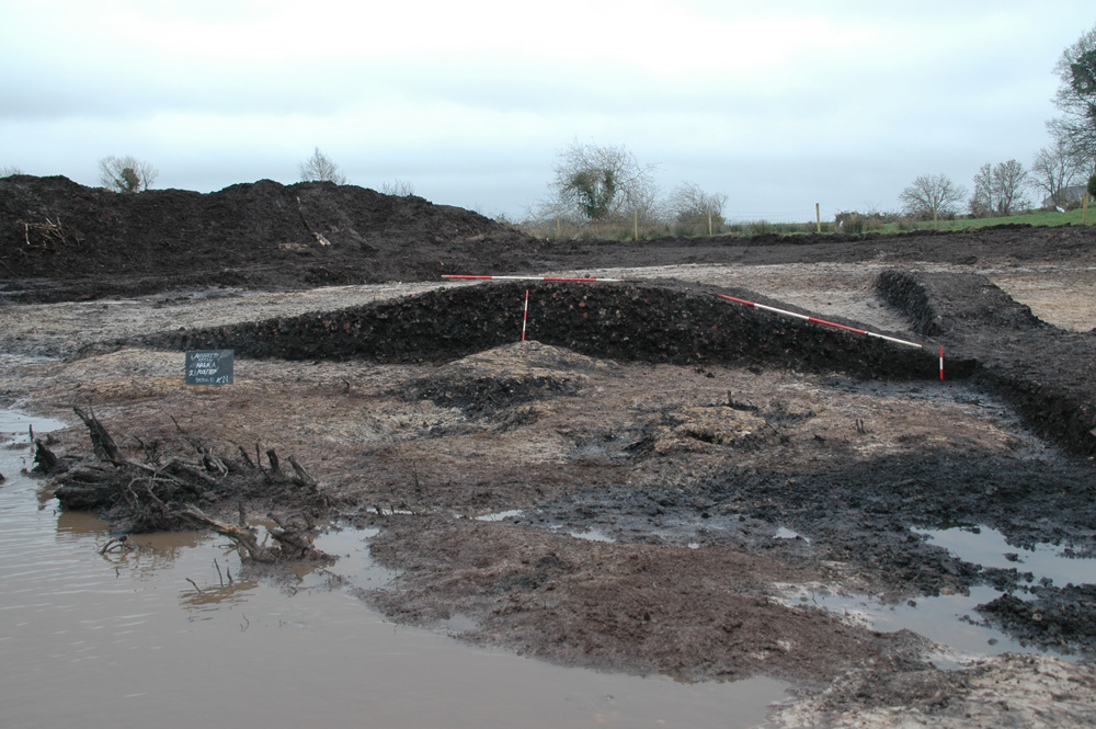
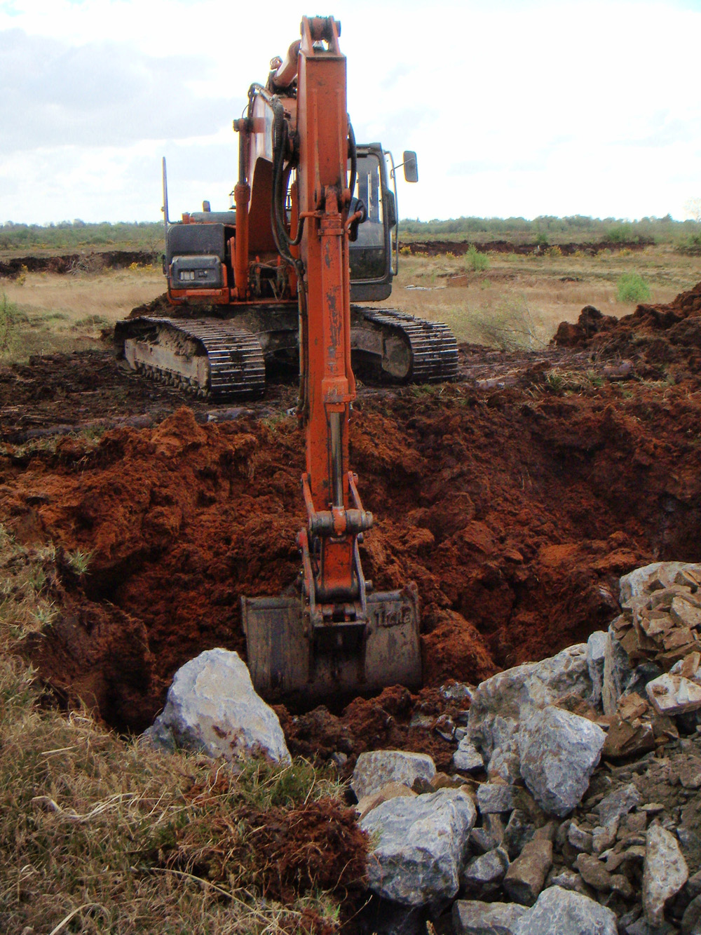
Summary: A wooden trackway was discovered during archaeological monitoring of construction work in Annaholty Bog and subsequently excavated. The trackway was up to 7m wide and 65-70m long, connecting two islands of dry ground within the bog. Dendrochronological dates place the felling of the trees around 40BC (with thanks to David Brown, QUB).
